I’m thinking of starting a new project of putting up maps that I think will help to enhance my own perception of history and the struggle between power and liberty. Hopefully it catches on. I’ll probably have a small vignette to go along with some of the maps, some of the time. At least I hope to. This’ll help me clarify my own thoughts and perhaps even help to clarify the thoughts of others. So without further adieu:
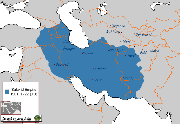
Behold: the Safavid Empire at the extent of its power. I’ll bet those regions beyond the modern borders (in orange) that are in blue are regions of conflict that include high levels of secessionist or devolutionist tendencies in those states. Look at where Baghdad is at! I’ll see what else I can come up with. Can you imagine the bimbos in Washington attempting to impose democracy and enforce the arbitrary boundaries drawn up by Britain and France on this region?
I’ll bet it looks something like Iraq!

Brandon,
I think this is a great idea. Maps are a huge help in understanding history. We have tons of them in our homeschooling house.
Good thought- I ‘m a map guy, too. Go for it.
Thanks guys!