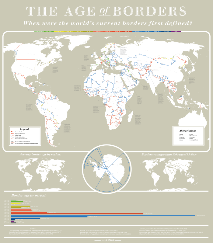
I think the border dates for Europe are a disingenuous in places, such as the Czech Republic’s 1459 border with Germany (neither of these two countries existed then) and the borders of the Balkan states (Yugoslavia?). Other than a few discrepancies here and there, it’s a pretty cool map. (h/t Bill Easterly)

Pretty cool map. For some reason I can’t open it bigger or “click to zoom” on mobile. It seems like it keeps trying to redirect me somewhere and ends up being a blank page.
Thanks. I tried it on my phone (a really old Samsung) and it worked fine (I zoomed in manually), but my browser crashed after a few minutes.
I know that doesn’t help, but I’m all about solidarity baby!
PS: Happy Easter!